Geospatial Analytics Database
with Speed, at Scale
For Complex Geospatial Questions
Geospatial at its core
Real-time Visualization
Geospatial Graphs

Geospatial Visualization Pipeline
One of the core challenges with displaying spatial information is moving data from the database layer to the visualization layer. Serializing and moving millions to billions of objects from one technology to another takes time.
Kinetica is able to solve this bottleneck by generating geospatial tiles directly on the server through a Web Mapping Service (WMS). WMS tiles are typically used as overlays on top of a map. The type of image tiles returned, the data used to generate the tiles, and the graphical styles in the tiles are specified in the query string of the WMS call.
This demo shows the Kinetica engine powering accelerated analytics on a 14 billion record dataset of raw mobile signal events.
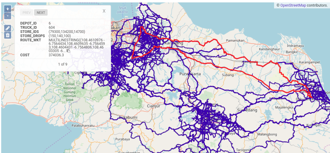
Leverage graphs for optimal routes or for network planning
Kinetica's graph API enables you to model spatial data as graphs. Then solve difficult questions using SQL queries, or with in-built graph solvers. Outputs from solvers can be piped directly to maps.

Property Queries
Solvers
Map Matching
Explore Geospatial Data with a Variety of Tools
Kinetica integrates with a wide variety of BI Tools through it's ODBC/JDBC Connectors. Developers can leverage the REST API and language specific connectors to build rich interactive geospatial applications. Or perform quick analysis using Kinetica's own built-in BI framework.
Geospatial Visualization for Tableau
Kinetica Geospatial Visualization for Tableau, a brand new extension from Kinetica enables geospatial visualization at virtually unlimited scale. Instead of shipping data up to Tableau for processing, the extension uses Kinetica’s Web Map Service (WMS) endpoint to leverage server-side rendering. This enables visualizations on massive datasets in real time. With every pan and zoom on the map, Kinetica dynamically renders images on your live data source and sends them to the map.
Learn More »Kinetica Reveal
Kinetica comes with Reveal — a web-based BI framework that makes it quick and easy to start exploring geospatial data. Reveal also connects with Kinetica's geospatial pipeline for advanced mapping and interactive location-based analytics.
Learn More »Build Real-time Location Applications on Massive Datasets

